|
Azerbaijan Azarbaycan
Respublikasi
Area: 86,600 sq
km
|
|
Climate: dry, semiarid
steppe
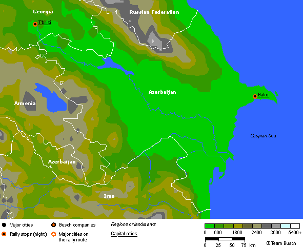
Terrain: large,
flat Kur-Araz Ovaligi (Kura-Araks Lowland) (much of it below sea level)
with Great Caucasus Mountains to the north, Qarabag Yaylasi (Karabakh
Upland) in west; Baku lies on Abseron Yasaqligi (Apsheron Peninsula)
that juts into Caspian Sea
Elevation extremes:
lowest point: Caspian Sea -28 m highest point: Bazarduzu Dagi 4,485
m
Geography—note:
landlocked
|
|
Population: 7,908,224
(July 1999 est.)
Ethnic groups:
Azeri 90%, Dagestani Peoples 3.2%, Russian 2.5%, Armenian 2%, other
2.3% (1998 est.) note: almost all Armenians live in the separatist Nagorno-Karabakh
region
Religions: Muslim
93.4%, Russian Orthodox 2.5%, Armenian Orthodox 2.3%, other 1.8% (1995
est.) note: religious affiliation is still nominal in Azerbaijan; percentages
for actual practicing adherents are much lower
Languages: Azeri
89%, Russian 3%, Armenian 2%, other 6% (1995 est.)
|